

Dividing ridge
The Verkhovyna Watershed Ridge is a high-mountain polonyna massif (Mount Pikuy, 1408 m) on the border of the Zakarpattia and Lviv regions. The ridge bears this name for a reason. At its foot rise the sources of the largest rivers of the Carpathians and of Europe - the Dniester, the San, the Uzh, the Latorica. The route along the ridge is fairly gentle - with practically no significant elevation changes, suitable for beginner hikers.
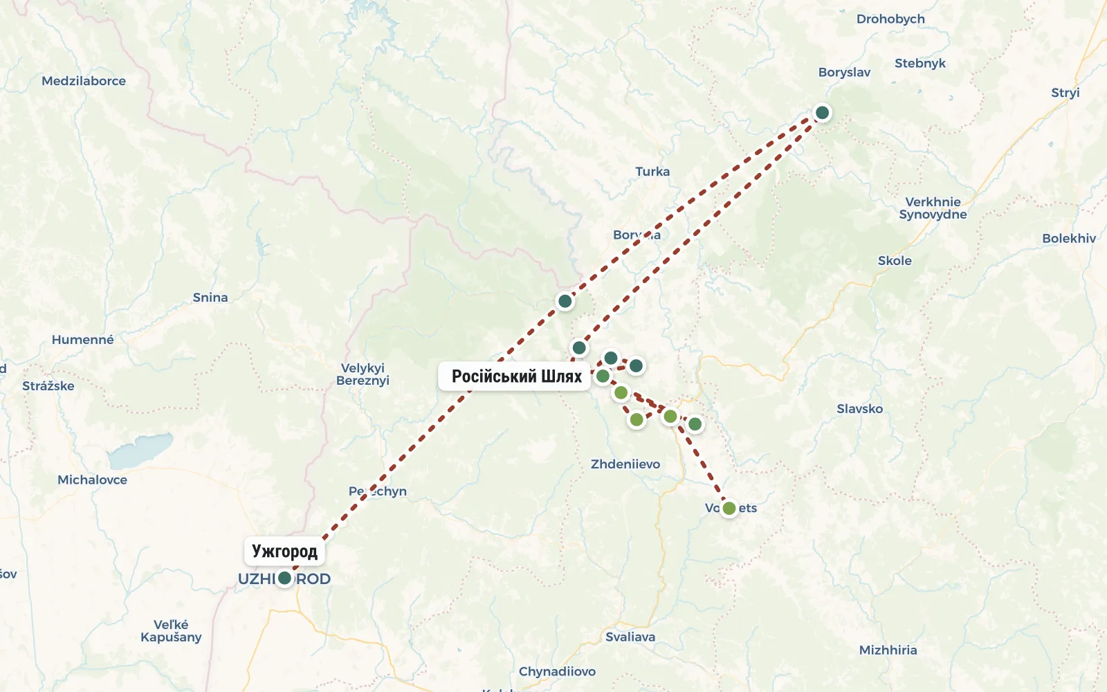
RouteRoute map
 Open the map →
The GPS track is not digitised yet, the line is approximate (by key points).
Along the trailWhat you will see


Day by dayItinerary
1 Day 1. Uzhgorod, village Uzhok, Mount Drogobitsky Kamen, Mount Starostina, Mount Zhurivka.
Meeting of the group in Uzhgorod at the railway station at 7:50 am. By this time daily Kyiv (7-45) and Moscow (4-30) arrive
trains. At 8:30 we board the train to the Uzhotsky Pass. We get off at Uzhok station around 11 am and start climbing
Poloninu. After 4 km along the forest road we come out to Mount Drogobitsky Kamen - this peak is where the ridge actually begins.
From here you can see a beautiful panorama of the Uzhanskaya Valley and the villages of the Lviv region. Continuing along the ridge we notice already
The final destination of the route is the city of Pikuy. She will accompany us on our hike constantly, popping up from left to right. From the end of June
in the meadows you can pick a lot of blueberries, lingonberries, and blueberries (in autumn). Along the way we take the top of Mount Starostin, then -
Zhurivka at the foot of which we set up camp on a site among the stones overlooking Mount Ostruya (1408m.)
Distance 9 km.


2 Day 2. Pass Russian Path (1190 m), Mount Velikiy Verkh, .
We return to the main ridge and continue along the route. To the left and right of the ridge we can see fields
arnica, which blooms here in the second half of June. At the lowest point of the ridge is the Russian Path pass (1190 m)
which was used during the fighting of the First and Second World Wars. In memory of those events, a
cross. In addition, local residents of two neighboring regions use it as a shortcut. Climbing to the top of the Great
Top From here we can see (in a western direction) the Polish Beschady (Tarnica 1365m) as well as the neighboring mountains: Polonina Runa,
Acute, Lyutyanskaya Golitsa. After descending the peak, we go out onto the plateau where we will camp for the night, but from the side of Lvovskaya
areas. If you're lucky, we'll meet the Likhobor grooms, who graze wonderful horses here in the meadow.
Distance 8 km.


3 Day 3. Mount Nondag (1303m), Mount Pikuy (1408m), s. Bilasovitsa, Volovets.
We slowly climb to the top of Nondag (1303m). From here it’s already a stone’s throw to the highest peak of the mountain ridge
Pick. Increasingly, there are scattered stones and massive rocks along the road. After descending to the foot through the undergrowth we begin
rise. The cone of the mountain is topped with a four-meter stone tetrahedral table, which was built by the residents of the village. Gusny in 1935
honor of the first president of Czechoslovakia (in those years Transcarpathia was part of this country) Masaryk. From here it opens
panoramic view of the Borzhavsky ridge. Along the marked path passing between the stones, we begin the descent to the village of Bilasovitsa. To the village
We get there around 16:00. The Kyiv Chop highway runs here. We take the bus and go to Volovets (20 km) where it is already possible to get on
to the desired train (Uzhgorod - Kyiv 17:50, Uzhgorod Kyiv 19:10, Uzhgorod - Odessa 21:18, Mukachevo - Lviv 18:43)
Distance 13 km.


DetailsIncluded
Not included
- ✕Transport to Uzhgorod
- ✕Volovets
- ✕Transfer to the mountains and back
- ✕Rental of personal equipment
- ✕Costs are not specified in the program
Trip conditions
The instructor reserves the right to make changes to the route depending on the weather, state of the group and other factors. This is a self-guided hiking trip. All necessary equipment and food are distributed among the group and throughout the hike we carry it in our backpacks. Read more about our approach to camping life in the article "How everything happens".


