The plan of a hike(trekking tour):
1 day. Antalia, Gojnjuk, a canyon of Harmony.


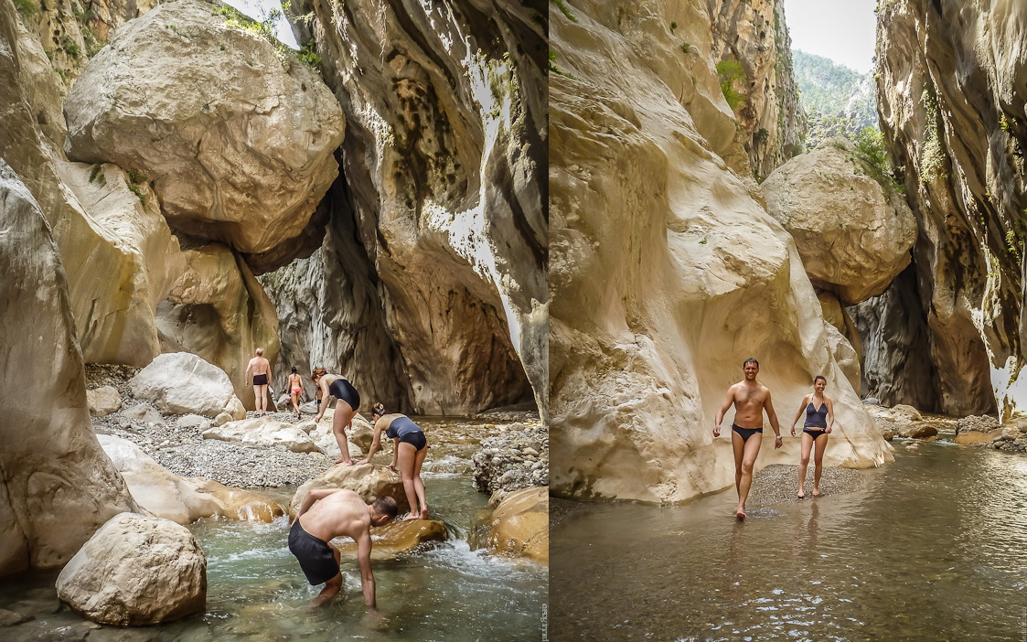
 the Meeting of group at 9:30 at the international terminal at the airport of Antalia (check up roaming and in advance put money on mobile). We distribute(allocate) products and it decided as to go further. Variants: a taxi, такси+автобус, razvozki tour operators. It is necessary to us in Gojnjuk (about 40 km from the airport). In this resort settlement it is done(made) above itself effort, we turn to the sea... A back also we go to mountains along picturesque gorgoj small rivers. Through 4 km we shall appear in rather nice canyon which should be investigated(researched). Here passes(takes place), so-called, the Track of Harmony. On a lodging for the night we remain in nearby from a canyon.
Distance: 8 km. Ascent: 200 m.
2 day. Ovachik, foothills Gjuzelkatran.


") the Yesterday's canyon, unfortunately to pass(take place) with backpacks through it is impossible. We bypass a difficult site through mountains to continue rise upwards on gorge on their other party(side). As a result we leave on JAjlu. As well as in Crimea, jajlami in Turkey name plateaus or pastures. In this case we deal plateau (height 900 adjoining to ridge Gjuzelkatran (nearby 2000). Here we change direction movement and almost across we direct on the south, aside the Olympus dominating over vicinities. On a lodging for the night we shall rise at a spring between Ovachikom and Gedelme (mountain small villages).
the Yesterday's canyon, unfortunately to pass(take place) with backpacks through it is impossible. We bypass a difficult site through mountains to continue rise upwards on gorge on their other party(side). As a result we leave on JAjlu. As well as in Crimea, jajlami in Turkey name plateaus or pastures. In this case we deal plateau (height 900 adjoining to ridge Gjuzelkatran (nearby 2000). Here we change direction movement and almost across we direct on the south, aside the Olympus dominating over vicinities. On a lodging for the night we shall rise at a spring between Ovachikom and Gedelme (mountain small villages).Distance: 16 km. Ascent: 600 m.
3 day. Gedelme, JAjlakuzdere.


 In village Gedelme we fill up stocks of a food and we look local sights - a tree, to which 2,5 thousand years, a picturesque grotto, ruins of the ancient lock and a camp of nomads. We continue a way aside the Olympus on plateau zarosshemu a coniferous wood. Today it would be quite good to reach a saddle of the Olympus. But this plan too derzok, dostatono will quite reach(achieve) small village JAjlakuzdere.
Distance: 12 km. Ascent: 300 m.
4 day. Mountain the Olympus - Tahtaly.

")

") Most trudnyjj and "high" day of a hike(trekking tour). First 600-meter rise from JAjlakuzdere up to a saddle of the Olympus (the turkish name - Tahtaly). On sedovine we hide in stones a part of things and it is(are) sent to a radial output(exit) to top of the Olympus (2365. It(she) most likely will be still covered by a snow, therefore to guarantee, that we there shall reach, I cannot. Nevertheless, to try(taste) it is necessary. After an ascention we come back to a saddle where we spend the night. If there will be forces, pass(take place) 2 more km up to turstojanki the Goal-n®Ѕб.
Most trudnyjj and "high" day of a hike(trekking tour). First 600-meter rise from JAjlakuzdere up to a saddle of the Olympus (the turkish name - Tahtaly). On sedovine we hide in stones a part of things and it is(are) sent to a radial output(exit) to top of the Olympus (2365. It(she) most likely will be still covered by a snow, therefore to guarantee, that we there shall reach, I cannot. Nevertheless, to try(taste) it is necessary. After an ascention we come back to a saddle where we spend the night. If there will be forces, pass(take place) 2 more km up to turstojanki the Goal-n®Ѕб.Distance: 10 km. Ascent: 1200 m.
5 day. Bejchik, Ulupinar, the Chimera


 Today it is necessary to us mad dump of height. From a saddle (1780 highest coastal mountains we go down almost up to the sea. From sights for today are planned certain botanical restaurant Ulupinar (at all I do not know that to wait from an institution with such name) both a great and awful Chimera. Here I do not doubt of its(her) appeal. Legendary ognedyshashchee a monster pogrebeno under thickness of rocks, and only languages of fire are pulled out on a surface already many thousand years.
Distance: 14 km. Ascent: 100 m, dump of height: 1500 m.
6 day. CHiraly, Mediterranean sea, Olimpos, mountain Musa


 Through resort small village CHiraly we at last shall leave to Mediterranean sea and we can be expiated deservedly in it(him). Then on a sandy beach where for a laying of eggs sea turtles at night creep out, we shall go to Olimposu.
Olimpos - a huge complex of antique ruins which will please us with Lycian sarcophagi, the Greek theatre, the Roman gate, the Genoa fortress. B all this in present(true) turkish jungle. Water from everywhere flows, streams run into the river, the river in the sea, and the sea... The sea calls and attracts. The main thing to not forget, that up to a lodging for the night to us 7 more km across and 700 meters upwards (we go on mountain Musa).
Distance: 11 km. Ascent: 700 m.
7 day. Adrasan, turkish camels,


 From mountain Musa where we spent the night, again we go down to the sea. This time in bay Adrasan. In the same settlement we "refuel" oranges and we go further along coast smoothly rising on the next hill (380 with a kind on the sea. There it is supposed to find crowd of the turkish camels peacefully grazed on lawns...
 Distance: 12 km. Ascent: 400 m.
8 day. Cape Gelidonija, the Beacon.
the Cape Gelidonija is the present(true) edge(territory) of light, for which only a couple of islands and boundless Mediterranean sea. We shall bypass cape on perimeter on a track winding among enormous boulders and fragrant southern needles. And we become on a lodging for the night on the most southern extremity of cape, nearby to a lonely beacon in the evening.
Distance: 10 km. Dump of height: 130 m.
9 day. Karaoz, Mavikent.
On other party(side) of cape there is a huge bay. Along its(her) coast we also shall go. Some times there will be an opportunity to approach(suit) to water (certainly to be expiated). Our purpose for today - settlement Mavikent.
Distance: 14 km. Dump of height: 160 m.
10 day. Kumlucha, Antalia
Since the morning we shall start "to get out". First it will be necessary to reach autostation in the city of Kumlucha (tomato paradise, hothouse capital) .ottuda by the bus we shall go to Antalia. There we shall settle down on a lodging for the night in one of campings, and the rest of day we shall spend for survey of " old city " - narrow ulochki, souvenir shops and the stunned kind on mountains which we have grown fond.
11 day. The plane.
We go to the airport, we are registered(recorded), we depart (who wants - can remain).
The probability of is great that we shall pass(shall take place) the pedestrian part of a route more quickly, than is written in this plan. Then at us will be two variants: to become with tents in any silent bay and to relax on the sea, or prodozhit movement on the West on the Lycian track. Believe to me, there still is on what to look.
Понравился маршрут?
|
Cost of round: 1600 griven (7500 roubles)
Payment by cash in the end of a hike(trekking tour).
Into cost of round enters: three meals a day on a route, services of the instructor, the medical insurance.
Into cost of round does not enter: the turkish visa ($30), flight there-back ($250), visiting of paid sights ($20-30), crossings(moving) across Turkey ($40), a feed(meal) at restaurants, residing at campings and shelters ($30). All the above-stated prices are rather approximate.
Flight to Antalia and back.
Below perechislenny flights of airline Vizzejr (Wizzair.com) "suitable" to the declared schedule of a hike(trekking tour). For certain there are also other variants. Let's search together. Especially interest Moscow loukostery and charter-parties (we in fact invite in a hike(trekking tour) across Turkey not only kievljan and ukraintsev).
* there - on May, 17th, Borispol - Antalia, a start in 6 mornings, the price: 1149 grn + 173 grn (luggage)
* back - on May, 28th, Antalia - Borispol, a start at 9:25, the price: 459 grn + 173 grn (luggage)
Pay attention what to pay for luggage in advance (through the Internet), in 2 times is cheaper, than at the airport (173 grivnas instead of 356).
Conditions of round.
For a trip to Turkey the passport is necessary! The visa give out directly at the airport of Antalia for 2 minutes and 30 dollars.
All lodgings for the night are planned in tents though in some cases, at desire, it is possible to settle down in shelters or gesthauzah. The Great bulk of the foodstuffs we carry to Turkey with themselves. On a place there will be an opportunity dokupat fruit, sweet, bread, dairy products or in general to eat at restaurants (at least 1 time in 3 days).
The instructor reserves the right to itself to make changes to a route depending on weather, conditions of group and other factors. The Lycian track at present is an experimental route, with all following consequences.
Additional materials
* the List of equipment - for a hike(trekking tour) across Turkey the same, as for years(summer) Crimea.
Card(Map) of a route " the Lycian track "