

Marmarosy range
Important! To issue passes to the border zone, we submit the participants’ data 10 days before the start of the hike, after which enrollment in the group is closed. Don't be late!
To receive a pass you will need to tell us your full name, exact date of birth, passport number and registration address.
Trek plan:
RouteRoute map
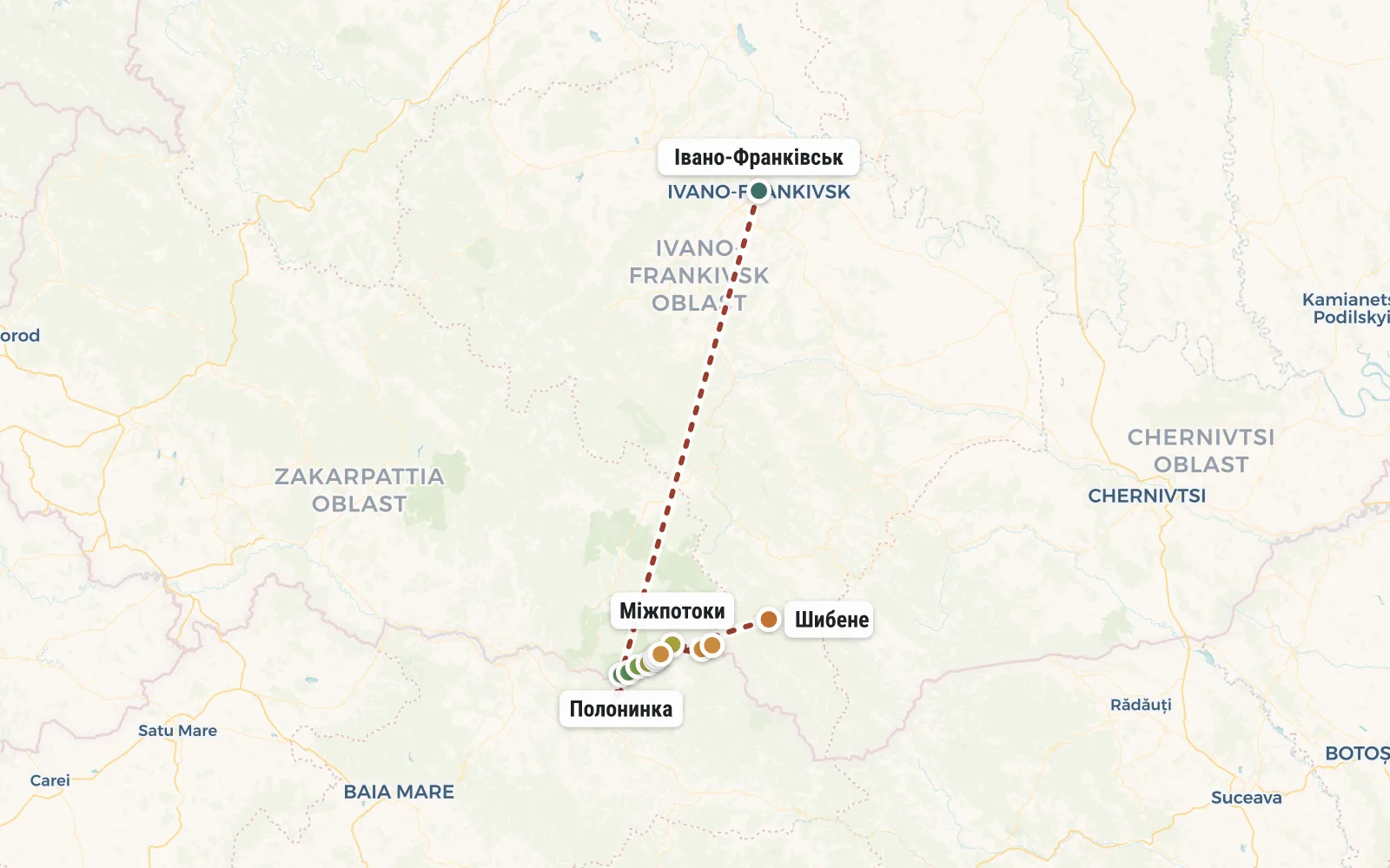 Open the map →
The GPS track is not digitised yet, the line is approximate (by key points).
Along the trailWhat you will see


Day by dayItinerary
1 Day 1. Ivano-Frankivsk, Delovoe village, White Potok river
Group meeting at 10 am at the Ivano-Frankivsk railway station. Then we take a bus to the village of Delovoye, where the instructor receives passes at the border post. After that, we put on our backpacks and walk upstream of the White Stream River for a couple of hours. Overnight in tents in a clearing.
Distance 3 km. Elevation gain: 200m.


2 Day 2. Mount Poloninka, Strumki valley
Through the forest we reach the Romanian border in the area of Mount Poloninka (1625m). We don’t go to the top, but go around it with a traverse, heading towards the Strumki valley, where we will spend the night with a view of the White Stream canyon and the neighboring Shcherban mountain.
Distance 10 km. Elevation gain: 1000m.


3 Day 3. Mount Pop-Ivan Marmarossky (1937 m), Cherny Grun tract
The forest gives way to thickets of zherep - a coniferous alpine dwarf tree. We go to Mount Shcherban. From the pass in clear weather you can see the villages on the Romanian side. We climb to the highest peak of Marmaros - Mount Pop Ivan (height 1937m). This is where the wonders of the Hutsul Alps are concentrated - snowfields, circuses and other harsh beauty. We spend the night in the Cherny Grun tract.
Distance 6 km. Elevation gain: 500m.


4 Day 4. Mount Mezhipotoki (1713 m), Mount Mika Mare (1815 m)
We continue to walk along the Ukrainian-Romanian border along the Marmaro ridge. The path climbs up and then falls down again. Thus, we will simultaneously conquer the peaks of Bendyask and Golovacheu. And when we cross the third peak (Mezhipotoki Mountain), we will see today’s resting place - the slopes of Mount Mika Mare. We set up camp and after a short rest we go radially to the top of Mica Mare. From there you can clearly see the Romanian Marmaros and their peaks Ferkeu and Mihailikul.
Distance 11 km. Elevation gain: 400m.


5 Day 5. Korbul Pass, Stog Mountain, Radul Valley
We are still walking along the border. Today, the traverse of the ridge in Marmaros is complemented by new landscapes - from the Korbul pass we will see Mount Pop Ivan Chernogorsky and the famous White Elephant Observatory. After lunch at the sources of the White Tisza, we will go on a radial route to Mount Stog (1650 m) to the old border post where Czechoslovakia, Romania and Poland once bordered. And from there you can see Chivchyny - another mountain range. We return to our backpacks and continue to descend. In the Radul meadow we will try to catch the shepherds and buy fresh cheese from them. A little lower, in the valley of the Shibene River, we set up tents.
Distance 15 km. Height drop: 700m.


6 Day 6. Village Shibene, Ivano-Frankivsk.
Today everything is simple - we go down along the river to the village of Shibene. From there we go by bus to Ivano-Frankivsk station. Take return tickets for trains departing no earlier than 20:00.
Distance 9 km. Height drop: 200m.


ReviewsTraveller reviews
I went on two trips with Oleg Boyko and two with Yuri Yurkiv. The most difficult question remains who to choose as an instructor for your next hike in the summer of 2016. It's like comparing the operas "Don Giovanni" and "Carmen", which is better, if you understand me. There is no clear answer.
Of course, nature comes first! In the forest, in the mountains you forget about fatigue, work and problems. And the most important thing is the attitude with which you go to the mountains and the right people next to you! In good company, you won’t be afraid of a steep climb, a stormy wind or an encounter with wild animals. If you don’t allow negativity to ruin your vacation, you will get a lot of impressions and will definitely want to come back.


