Seas, Rivers and Lakes of Ukraine
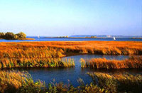
 The Black Sea area is 422 000 sq. kilometers. The Kerch Strait links it with the Sea of Azov and the Bosporus with the Sea of Marmara. The length of the Black Sea coastline within Ukraine is over 1500 km. with the beaches predominantly sloping (except in the region of the Crimean Mountains). In the northeastern part of the coast, numerous estuaries and lakes had formed separated from the sea by narrow sandy strips. The Black Sea is over 2000 meters deep in the center, but within the zone adjoining Ukraine the depth of 100 to 120 meters prevails. Considerable deepth is found only in the region of the Southern Coast of Crimea.
Water temperature in the northwestern part of the Sea fluctuates in winter within the range of from 0 to 8? С ( 32? F to 46.4?F) . The surface water temperature in summer reaches 23? to 25? С (73,4? F to 77? F).
The salinity of water is from 13% to 14% in the northwestern part of the Sea, reaching 16% near the Southern Coast of Crimea. At the depth of 150 to 200 m water is saturated with hydrogen sulphide; hence, organic life is concentrated predominantly in the upper layers.
The area of the Sea of Azov is 39 thousand sq. kilometers. Its beaches are low-lying, straight, and characterized by tongues of sand (in Berdiansk, Obitochna, etc.). The biggest, Arbatska Strelka, is 112 km long, separating the Sivash Sea, the system of small bays with mineralized water. With the maximum depth of 15 m, the Sea of Azov freezes at its shores in winter. In summer, the surface water temperature reaches 25? or 30? С(77? F…86? F). On average, the salinity is from 10‰ to 11‰, with its maximum of 25‰ in the Sivash Sea.
Rivers
Overall, there are more than 73 thousand rivers in Ukraine with over a hundred of them longer than 100 kilometers. The rivers of Ukraine predominantly belong to the basins of the Black Sea and the Sea of Azov with the exception of Southern Buh and other left bank tributaries of Vistula that are part the Baltic Sea basin.
The Dnipro River is the third in length in Europe after the Volga and the Danube. It springs in the Valdai Hills in Russia, flows into Dnipro estuary on the Black Sea. It divides the territory of Ukraine from north to south into its right bank and left bank, covering almost half of the country with its basin. It is a horizontally flowing river with a wide flood bed. Its right bank steeplp rises up from 50 to 150 meters over the water level, while the left bank is low-lying and mildly sloping. The largest tributaries, Prypiat and Desna, are navigable.
The Danube River passes through the territory of Ukraine in its lower flow and pours into the Black Sea creating large delta of three branches. The River is the major trade water route that connects Ukraine with many countries of Europe. The most important tributaries of the Danube in Ukraine are Tisa and Prut.
Lakes
There are over 20 thousand water reservoirs in Ukraine. Three thousand of the number are lakes located predominantly in Polissia region, Coastal Black Sea lowland and steppe region of Crimea. The biggest fresh water lakes are the Yalpuh in the flooded area of Danube and Svitiazke in the Polissia region.
Lakes of the Coastal Black Sea lowland and of the steppe region of Crimea had formed mainly because of flooding of the river plains and gorges by the sea. Some of them are called estuaries (for instance, Dnister, Tylihulsk, Kuialnyk, and Molochny estuaries).
ukraineinfo.org